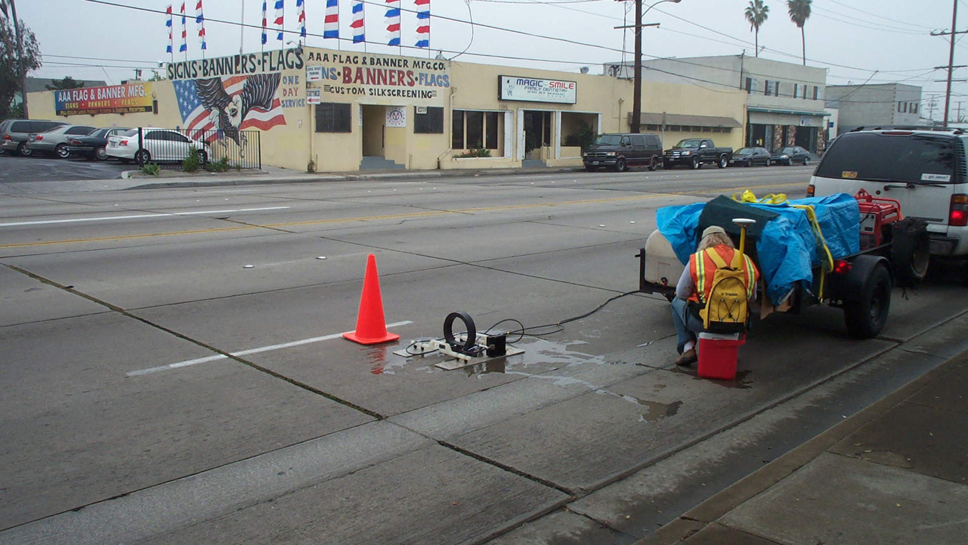
Pulser™

What is Pulser™?
Pulser™ Subsurface Survey System (Pulser™) is a system for subsurface geologic analysis. It is nonintrusive and has the depth of penetration of resistivity surveys while also offering almost the same vertical resolution of ground penetrating radar (GPR). Pulser™ is a geophysical system used for the identification of geologic traps and mitigation paths. The system is designed to partially mimic the vertical resolution of standard GPR while improving the depth of penetration due to resistivity components to define underlying geology. The system eliminates the drilling required for stratigraphy determination by utilizing ground truth data already available, and replaces it with a simple, mobile, noninvasive data collection system. Pulser™is used to map shallow geology to approximately 350 feet below ground surface with a vertical resolution as low as two feet.

Pulser™ is a fast means to non-intrusively determine the 3-dimensional distribution of lithologic and stratigraphic units to a depth of 350 feet below ground surface.
This proprietary technique generates reflection patterns from a hybrid system using resistivity and GPR technologies.
The reflection patterns are utilized to detect lithologic breaks based on changes in mineral composition, porosity, and material (air, water, contaminants, etc.) filling the porosity.
The resulting signals are calibrated to existing geologic databases. A total database is developed to create a complete geologic, geotechnical, and subsurface conceptual site model analysis for the purpose of remediation design.
The system is portable, compact, does not interfere with most operations, operates on dirt, asphalt, concrete, shell, grass, etc., and
requires approximately 5 minutes of set-up per data collection station.
Pulser™ produces a comprehensive geologic analysis of the site. This analysis facilitates the design of a more cost effective boring and recovery program in the design phase and in actual site remediation.

QRI defined the stratigraphy in the upper 100 feet of 56 acres in Hawthorne, California utilizing the Pulser™ Subsurface Survey System in conjunction with existing databases.


